Government & GSA
#GS-35F-0719P
Choose the webcam company with their own GSA schedule. Join the government agencies that already rely on EarthCam's experience to monitor and document their projects.
 Download a Specification for Your Bid - U.S. Government
EarthCam's Technology is Trusted on the Most Secure Projects
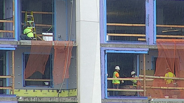
View jobsite activity and capture megapixel photographs to document contractor compliance, avoiding delays and disputes.
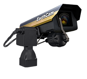
Time-Lapse Cameras
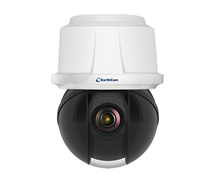
Live Streaming Cameras
Camera Options
Time-Lapse Cameras
Live Streaming Cameras
Camera Options
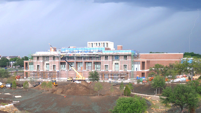
Construction Documentation
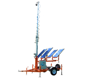
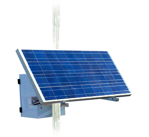
Rely on our portable solutions, perfectly suited for large footprints. With solar and wireless upgrades, create a truly autonomous solution for locations with little to no infrastructure. View jobsite activity remotely in real-time to make informed decisions quickly. Document progress with high-quality imagery and archive for historic record. The visual content is easily to analyze and can be shared across your organization for enhanced communications.
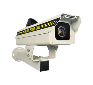
Security Monitoring
Feel confident that your entire jobsite is secure with continuous live views of activity. Monitor important areas and critical infrastructure from any location, review and analyze video recordings to protect your assets.
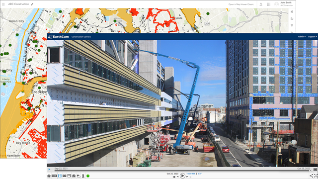
EarthCam Imagery & ESRI Platform
Import pinpoint locations for all your EarthCam cameras into ArcGIS Online. View highly detailed live imagery of map locations together with many layers of contextual data. Add insight to improve workflows and make real-time collaboration easy for many different commercial and governmental organizations.
Better Lives Through Visual Information®
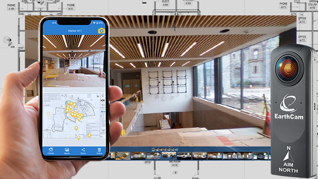
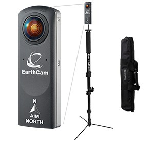
VR Site Tours – On-site 360 VR Photography
While other photography documentation solutions require professional photographers and several phases of complicated, time-intensive post-production editing, EarthCam has taken 6 processes and reduced it to one simple step with its improved photography interface and mobile app. This do-it-yourself efficient imaging technology eliminates the need for costly photography services and is a smarter way to communicate interior progress.
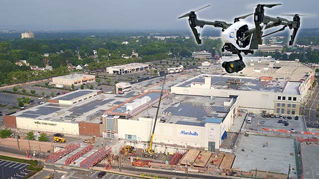
EarthCam Air – UAV & 3D Geospatial Imaging Service
Maximize the benefits of your project documentation process by combining all-weather cameras and 3D imaging with EarthCam's UAV and aerial imagery services. EarthCam Air also provides cloud-based storage solutions and distribution tools for sharing the unique content derived during UAV flights over your jobsite.
Marketing and Promotion
Maximize the benefits of your project documentation process by combining all-weather cameras and 3D imaging with EarthCam's UAV and aerial imagery services. EarthCam Air also provides cloud-based storage solutions and distribution tools for sharing the unique content derived during UAV flights over your jobsite.
Edited Time-Lapse Movies
Promote your projects with automatically-generated time-lapse videos using Control Center 8 or consult with our award-winning producers who will customize a cinematic finished product. Promote your projects to the public to generate excitement and share your dynamic video online.
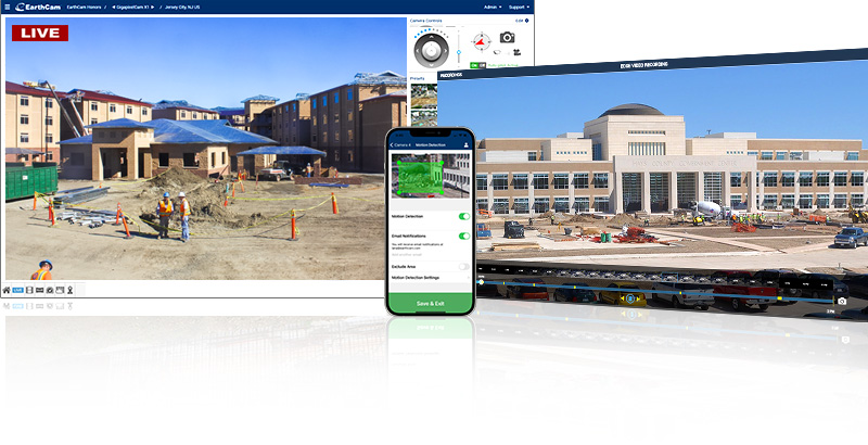
Software - Control Center 8
Our Software as a Service (SaaS) empowers users with high quality imagery, on-site data and collaboration tools all in one easy-to-use platform. EarthCam delivers proven capabilities for reducing the cost and complexity of managing your own visual information.
- People counting, in/out ratio
- Dwell time, occupancy of key areas
- Live stream secured & encrypted
- Flexible archiving options
- Time-lapse record & playback
- Weather data - current & historical
- Take instant snapshots anytime
- Email, save & share content
- Easily embed in any website
- Satellite map & site plan integration
- Image mark-up & comparison tools
- Automated progress reports
- Continuous support & training